Thoughts on photography and other related subjects from editorial and landscape photographer Craig Hudson
Tag: Road Trip
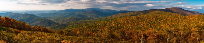
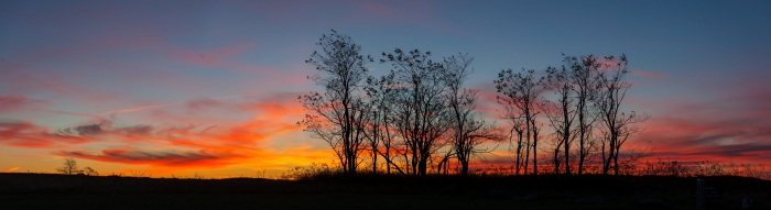
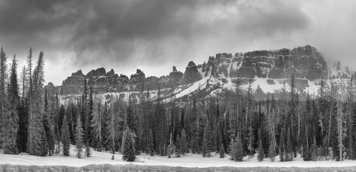
Skyline Drive, A place for Fall.
The air is getting cooler and pumpkin spice lattes have made their triumphant return, which means that Fall is upon us! Since the green leaves of summer will very soon be turning to their autumn hues, I thought i’d make a short post of one of my favorite places to experience the season while still remaining in the DC area. I’m talking about Skyline Drive in Shenandoah National Park, and if you haven’t already been there, the next couple months are gonna be just the right time to do so!
Note: Iv’e linked most of the images here to my website where you can see them fullscreen.
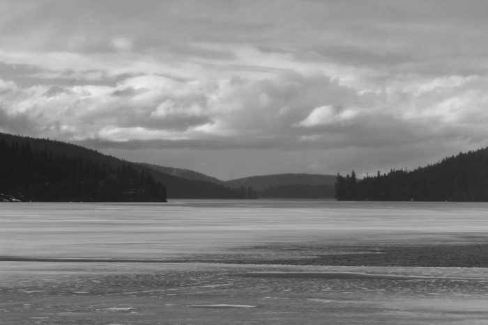
Beginning at the foot of Front Royal where the two branches of the Shenandoah River meet, Skyline Drive is one of the most majestic roads that there is in the entire Mid-Atlantic region. Built by the WPA in the 1930’s, Skyline Drive follows the crest of the Blue Ridge for over 100 miles South to Waynesboro and Charlottesville, offering stunning views of the Shenandoah valley and beyond from its 75 overlooks.
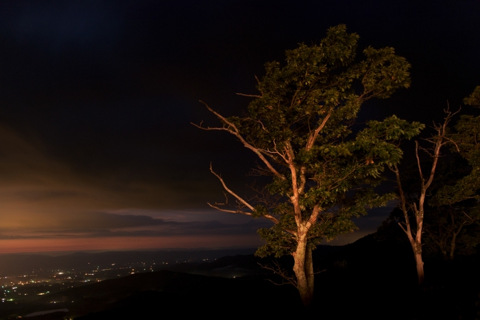
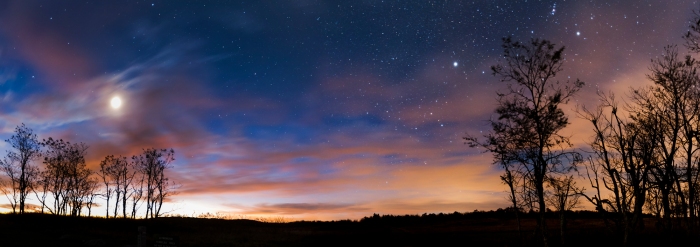
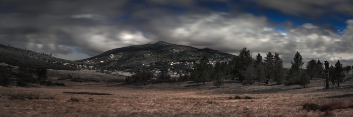
Autumn in Shenandoah National Park. As Seen from near the Pinnacles Overlook along Skyline Drive in the Early Morning.Blue Ridge Mountains at Dusk. Shenandoah National Park.Moonlit Night over Skyline Drive. Just South of Big Meadows. Shenandoah National Park.
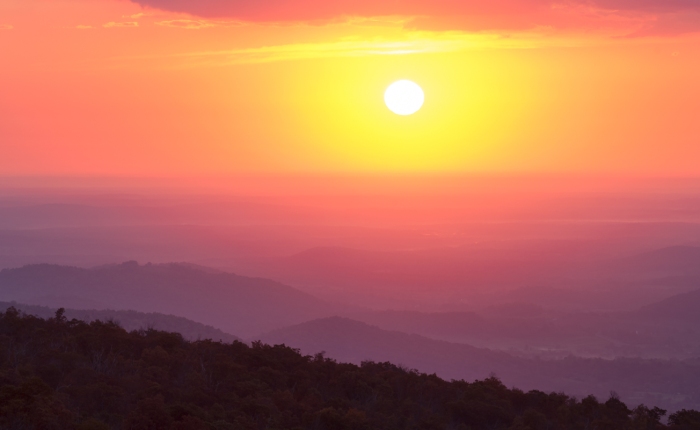
Sunset from Skyline Drive in Virginia’s Shenandoah National Park.Autumn Leaves along Skyline Drive.Looking into the valley from the Northern area of Skyline Drive.
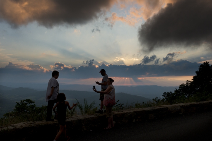
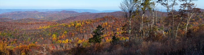
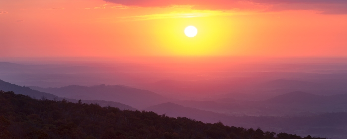
Skyline Drive is a part of Shenandoah National Park, with trailheads from the drive leading to waterfalls and mountain crests like Old Rag, and wildlife such as white-tailed deer and black bears abound. While the drive is wonderful at any time of the year, I truly believe it is at its best when the sun rises and sets, the former especially in the autumn months when the forests covering the blue ridge turn into a vast sea of crimson, yellow, purple and orange, with the air itself being refreshingly crisp and smelling of the season. Little Devil’s Stair, Hogback, Pinnacles, Rattlesnake Point and Big Run are just a few of the overlooks that offer great vantage points for sunrise and sunset, with sweeping views of the series of crests that make up the blue ridge and the many small valleys they create and the towns that line them; lighting up the valley as the sunset gives way to dusk.
Dusk along Skyline Drive in Virginia’s Shenandoah National Park.Sunrise from Little Devil’s Stair overlook. Shenandoah National Park Sunrise.
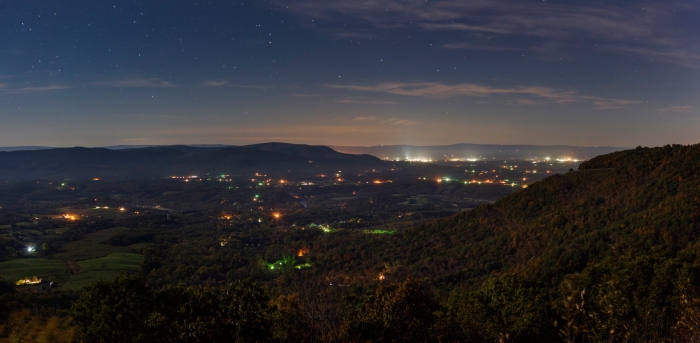
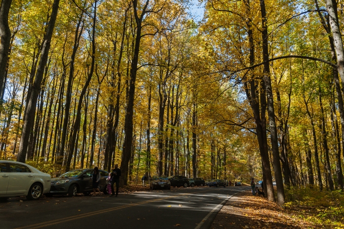
In the autumn months you will see cars dotting the overlooks facing towards the setting sun like a drive in movie theater, while surprisingly enough you’ll find even in the autumn months the drive almost deserted at dawn, allowing you your own private show of a brilliant sunrise. It’s also a good way to avoid the crowds of leafers, as they’ll be choking up the road going one way as you go the other. When autumn is at its peak, the forests lining the road turn vibrant hues of yellow, with tourists parked along both sides of the road to get out and take a look.
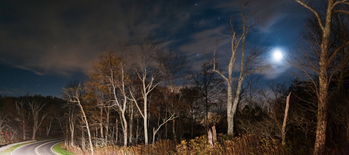
And for those who love stargazing…
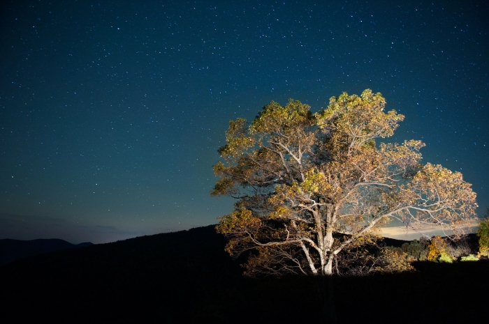
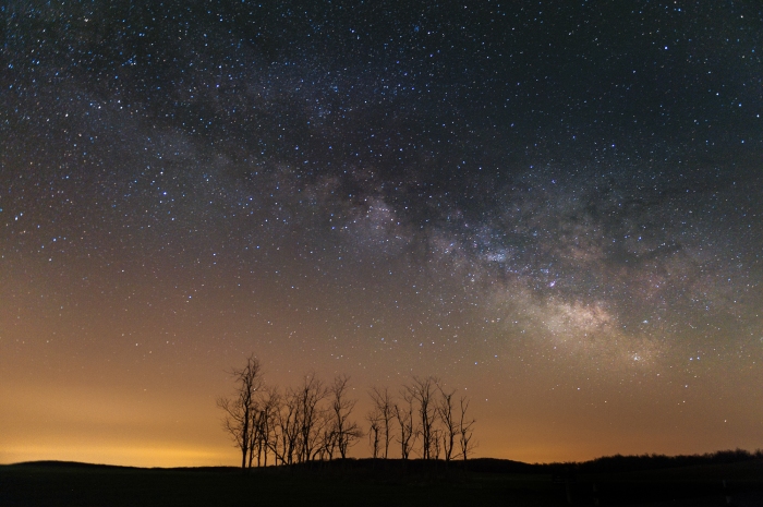
There are few places more magical at night than Big Meadows, true to its name lying almost at the midway point of skyline drive and offering an unobstructed view of the night sky from one end of the horizon to the other. Big Meadows is one of the more popular areas to watch meteor showers, and on a clear night one can easily make out the milky way. While it is most visible in the summer months, the milky way can still be seen any time of year.
Milky Way Galaxy over Big Meadows. Shenandoah National Park.Sunrise over Big Meadows, Shenandoah National Park. Virginia.
Big Meadows is also a wonderful place to experience the dawn, as one end of the horizon may still have stars dotting the darkened sky as the first hues of sunrise begin on the other.
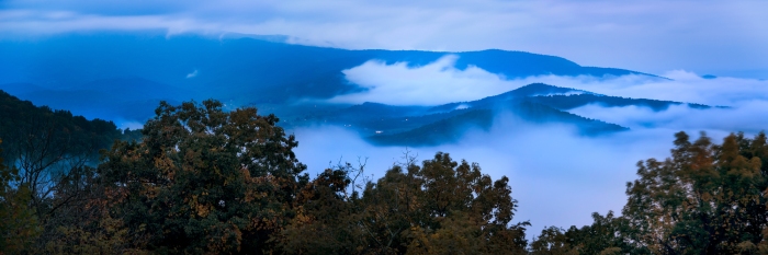
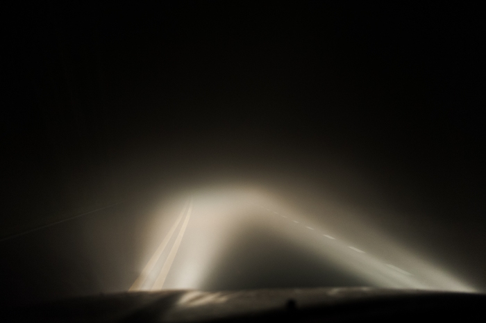
Note: Check for weather updates if you happen to be up there at night. Sometimes heavy fog will inundate the ridge, making driving a little difficult…
Not fun.
To get there: The Northern Entrance to Skyline Drive is located just outside of Front Royal, a small town 75 miles West of D.C. directly off of I-66, the drive itself there averaging around an hour and a half.
Entry Fee: $25.00 for a 7 day unlimited pass. However, their payment booths close at night while the road remains open. So if you’re trying to be cheap, or just want to leave a donation of your choosing, you can do that too.
This was an unplanned trip, unplanned in that I only knew I wanted to see Glacier National Park and possibly the Tetons. I left Friday afternoon and came back early Tuesday morning, and in that time covered nearly 2000 miles. Supplementing my current writings are notes jotted down in my pocket journal while on the trip, which are in italics.
On route 212 to Crow Agency.
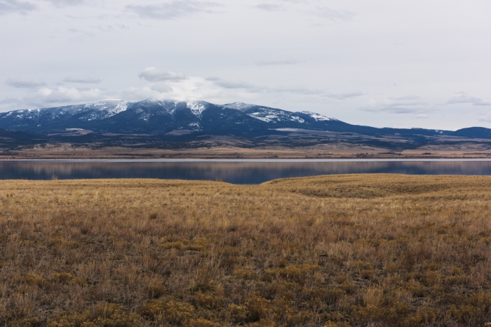
Starting out from Rapid City, the highway led along the northern border of the Black Hills to 212, a direct route through the Northeast corner of Wyoming into Montana. I had never been to Montana before and was looking forward to this trip.
Broadus, MT. 4:25 P.M:In Powder River country now. Montana is so far a continuation of Wyoming in terms of landscape, however taking into account its ridges and rocky outcroppings I think larger differences are to come.
While I had driven through Central and Northeast Wyoming; an impressively expansive land, Montana posessed a terrain I was not prepared for in scope and vastness. While ranch lands were aplenty, much of the landscape remained unrepresented by human intervention save for the nonnative grasses that permeated the land. The valleys, foothills and ridges stretched onward to the bighorn mountains; named so for the sheep that inhabit them.
Looking West from the Little Bighorn Battlefield.
I had arrived too late to tour the little bighorn battlefield which closed about an hour earlier, but I could easily say that the land itself was among the most beautiful that I have ever seen of any battlefield. Hawks flew high above the prairie dog towns that dotted the landscape.
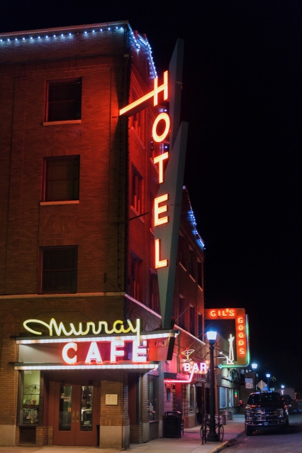
Continuing on after stopping briefly in Billings, It became dark as I was nearing Bozeman Pass. Stopping briefly to walk under the bright neon signs lining Livingston, I continued through the pass and down into Bozeman. Being home to Montana State University, Bozeman has a solid nightlife scene with a main street lined with bars, dance clubs, restaurants and cheap eats.
Neon lights in downtown Livingston, Montana.
Bozeman, MT. 11:15 A.M. Trying to make time to Helena, but land is incredible. The foothills and ridges surrounding Little Bighorn are among the most beautiful i’ve ever seen, stretching all the way to the Bighorn Mountains. Bozeman a wonderful college town with quite the nightlife for its size.
Being that I came through Bozeman pass at night, It was the next morning that I saw the series of mountain ranges that surrounded Bozeman. From there I immediately got on the road, wanting to make it to the area surrounding Glacier National Park before nightfall.
Westbound on I-90 from Bozeman on the way to Helena.
Helena: 1:15 P.M.The only place i’ve been that I can compare West Montana to would be Alaska.
The route to the state capital Helena was 287, with tilled fields and railroad tracks on one side and the Missouri river on the other.
The Missouri river and Mountains from Highway 287 on the way up to Helena.
Kalispell: 10:00 P.M. I started the day by drivingup from Bozeman, The drive up went well enough; though the distances are vast it certainly doesn’t feel that way with the terrain being as it is.
From Helena I took route 12 further West where the road abruptly rose into the hills, from which there were fantastic views of the surroundings valleys.
Looking East toward the Helena Valley from Highway 12 on the way to Kalispell
Descending from the ridge into another large valley, I suddenly turned onto a rural route that winded through ranch land that seemed to go on forever, only stopping at the foot of the nearest mountain ridge where a series of rainstorms were inundating the landscape.
Echo Mountain. One of the many mountain peaks that dominate Western Montana.
Driving past a series of lakes and mountain peaks, I eventually reached route 83, which hugged the Swan range for hundreds of miles to reach the Kalispell valley.
The road up was through a wide valley with mountains towering on each adjacent side, passing through little towns such as Swan Lake while rolling the windows up and down sporadically with each passing microclimate.
Looking West toward the Swan Range along route 83 toward Kalispell.Isolated cell over Route 200. On the way to Route 83, a straight shot up to Kalispell and Glacier National Park.Looking North on Swan Lake from route 83 on the way to Kalispell and Glacier National Park.
I saw two bald eagles feeding off of a carcass on the side of the road here. Also saw what I thought to be a black bear sneaking off of the road as i passed it before the lake itself.
A bald eagle takes flight on the side of the road. Highway 83, Montana.
I eventually arrived just outside of Glacier in the late afternoon as a series of rainstorms were passing over the range and surrounding area.
Passing storm over farmlands Southeast of Columbia Falls, MT.
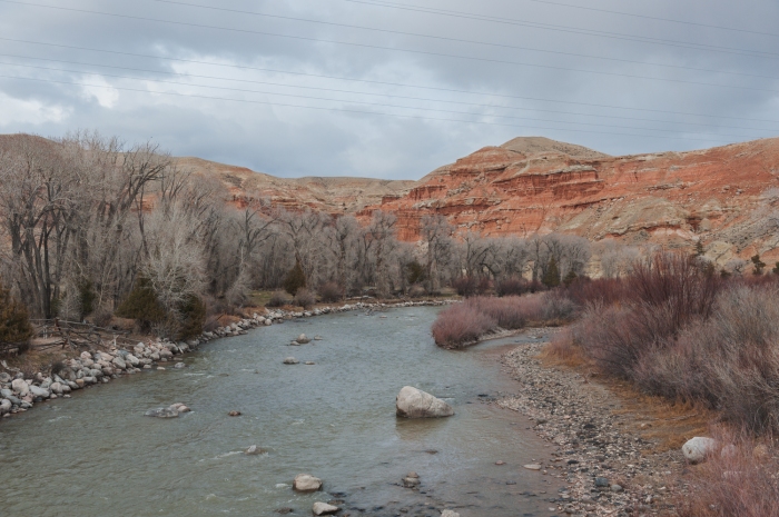
Passing through these farmlands, I turned Northeast onto a road that hugged the North Fork of the Flathead River, whose waters originate in the Canadian Rockies.
I drove up adjacent to the north fork of the flathead river; a sizeable river with a beautiful turquoise hue that very much reminded me of the waters in Alaska.
On the North Fork road leading into Glacier National Park.
The road zig-zagged through the immense gorge following the river until coming to a bridge over it which was gated off; closed for the season.
The road was closed over the bridge of the fork leading further into Glacier National Park, but I managed to get some decent pictures over the river before giving into the temptation of driving up the nearby trail creek road that ascended over the valley.
Sunset at the North fork of the Flathead River. Glacier National Park.Looking toward Glacier National Park from the North Fork road leading to Trail Creek.
I tried to find a clearing in those bastard juvenile pine trees but gave up after becoming exhausted trudging through knee-deep snow and failing to find any clearing significant enough for a clean shot of the best part of the sunset over the mountain peaks.
Looking toward Glacier National Park from the North Fork road leading to Trail Creek.
However I was able to see with my own eyes the violet and before that golden light surrounding the towering peaks as the sun went down, and that has been good enough for me.
Detail of mountains surrounding the flathead river gorge at dusk.Venus shines over the forest-lined gorge of the North Fork of the Flathead River in Glacier National Park.
That night I decided to head for Missoula, in order to put myself in a better position for the drive to the Tetons the next day. Even without the moon I could still make out the massive body of water that was flathead lake. Continuing on through small towns and rural areas, I was trailed by no less than four separate police vehicles; the officers most likely being bored out of their minds in rural Montana at 2 am.
I spent a little time walking around Missoula before heading South on I-15 to Northern Idaho.
Lima, Montana. Lima Peaks can be seen in the distance. Just before crossing the border into IdahoThe railroad tracks along Lima, MT. Just North of the Idaho border.
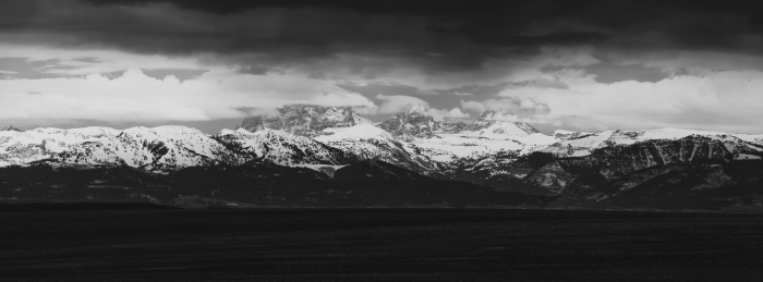
Tetons. 3:45 PM. Drove down from Missoula through mountain passes into Northern Idaho. I have never seen a valley so vast as that of which interstate 15 passes through. Coupled with one of the most visually fascinating concentrated rainstorms I have ever seen over an almost desert like terrain, it was quite a sight.
Rainstorm over Interstate 15. Idaho.Inside the Snake River Plain. Idaho.
Upon getting out of the rainstorm and driving through gentle rises the land changed again to tilled fields that stretched for miles.
I photographed what I could of the tetons from the Idaho side before entering the teton pass…
The Tetons as seen from Highway 33. Idaho.
was a bit riveting as it was dark and the highbeams of my car lit every piece of snowfall. It was a bit like being in the millennium falcon at lightspeed, stupid as that sounds. Found a good room and was given two slices of free pizza from a guy at Pinky G’s before having a beer at Snake River brewing.
Cowboy Bar in the town square of Jackson Hole, WY.
Jackson hole itself is beautiful, with the town square and look of the town was everything I hoped it would be.
The antler arches at the town square of Jackson Hole.
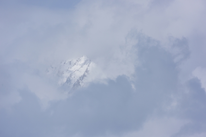
I have now been spending the day checking out areas per the suggestions of Lyford and the bartender at Dornan’s. People here are the nicest I think I’ve ever experienced in any particular place. I have seen quite a few moose around the park as I wait for fog to life which continues to inundate the Tetons. I hope that it will clear if only briefly for me to capture or at least see it before I turn east back to South Dakota.
A female moose is seen resting amidst the foliage in Grand Teton National Park.The Grand Teton is partially shrouded by passing fog. Grand Teton National Park.Grand Teton pokes through the winter fog clinging to the mountain range. Grand Teton National Park.At the Snake River overlook from which Ansel Adams took his famous photograph of the Tetons and Snake River.One of the famous barns in the Jackson Hole Valley.
Unfortunately it was soon after I wrote this that a snowstorm from the West moved in and completely inundated the mountains as well as the valley in quick succession. I decided to leave then, taking the road from Jackson Lake to Highway 26 which passed through the continental divide. The area itself was filled with buttes and peaks whose color and formations astounded me.
Pinnacle Buttes, Shoshone Wilderness. Wyoming.
Marker for the Continental Divide. Wyoming.
Trees and hills amidst Highway 26. Wyoming.
Eventually, 26 would lead into the fronier-styled town of Dubois and the desertlike terrain of the Wind River Reservation. I’d be hard pressed to think of another place where the difference in terrain from one side of the road to the other is so stark as it is here.
Looking right going West on Route 26.
Looking left going West on Route 26.
The wind river itself snaked under the road many times, adding an additional touch of beauty to a landscape that had suddenly turned into one that looked like Arizona more than anything else.
The Wind River. Just outside of Dubois, Wyoming.
It wasn’t long before the sun began to set, and I pulled over from route 26 onto a crest overlooking a reservoir. I took a couple frames as dusk was settling in.
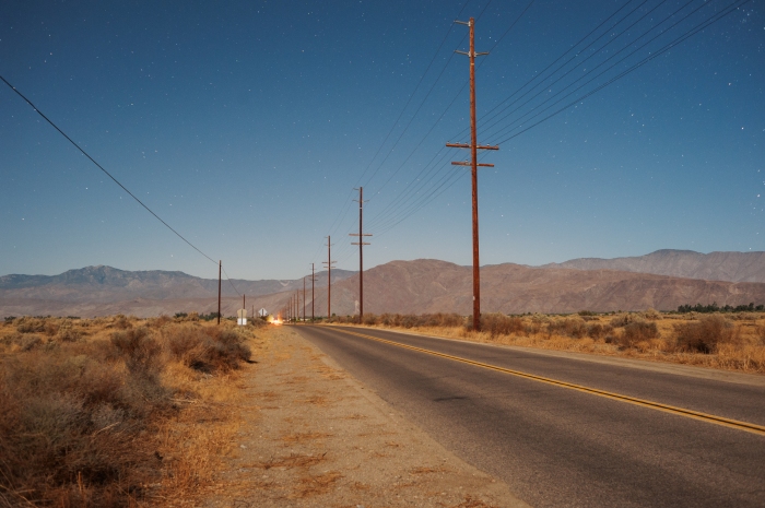
Dusk over Pilot Butte Reservoir. Wyoming.On the side of a road in Wyoming. Cows.
There are roads across central Wyoming that stretch 100 miles at a time in total darkness with not a light to be seen except those of oncoming cars and 18-wheelers. With both of us moving at over 80 miles an hour, the semi’s shake my car to an uncomfortable degree as they go by. In such conditions one cannot tell if a car is one mile away or ten, as there is nothing with which to associate the distance. It was a bit of a surreal experience really.
On the way to Casper from Shoshoni, Wyoming.
After what felt like a lot longer than 10 hours, I made it home early Tuesday morning. So i’m going to wrap this up. Thanks for checking out this post!
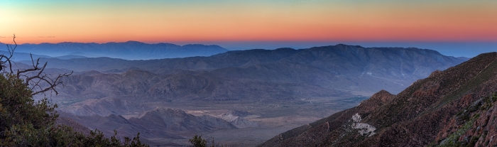
While not as visited or as well know as Joshua Tree, the Mojave or Death Valley, the Anza Borrego is in every way just as beautiful. Spread throughout this vast area are multiple landforms and climates. From the Laguna mountains where snow cakes the ground in winter and the winding pine filled valleys surrounding the road to the miles of desert flats leading to the Salton Sea, the largest body of water in California. This is a fantastic day (or night, whatever your preference) trip from the San Diego area.
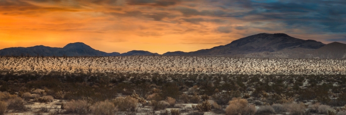
Sunset over the Anza Borrego Desert. As seen from an overlook along the sunrise highway.
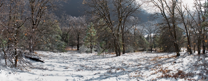
The Sunrise highway is one of my favorite roads. The drive is smooth, fun, and the views are wonderful. The drive can last for hours if you want it to, and there is a different view to enjoy at every turn. In the summertime at night the air is still very warm, upwards into the 70’s so you can roll those windows down as much as you like. In the winter however the higher elevations get a decent amount of snow.
A field atop the Laguna mountains is seen covered in snow in midwinter. San Diego County, CA
To get to the Sunrise Highway-Take Highway 5 North (LA) Out of Downtown and take the exit to Interstate 8 East (Mission Valley/El Centro) Stay on Mission Valley for a good long while (I’d say about half an hour maybe 45 minutes) until you take the exit for County Road S1 aka Sunrise Highway. From then on its miles and miles of forests, hills and overlooks into valleys and canyons.
Just after driving up and through Mt. Laguna, you’ll be driving through hills dotted with forests of charred trees from the Cedar fire that scorched much of the forests, leaving an eerie yet serene landscape.
The Sunrise Highway eventually ends by connecting to highway 79, where the road leads into the small touristy mountain town of Julian.
Moonlit night over Julian. HW 79. Laguna Mountains. San Diego County, CA
from there you will have two choices: turn left to enter the town and grab a bite to eat or take a right and continue on the road through mountainous terrain into the Anza Borrego Valley.
Alternate Route to Julian: If you’re a little pressed for time you can take the faster road of Highway 79 to Julian. The road is a curvy, uphill drive. After about 20 minutes, the road flattens out and you reach the plains surrounding Mt. Laguna.
Mt. Laguna in winter. The twinkling lights of Cuyamaca can be seen at the base of the mountain.
On approaching the mountain, 79 hugs the shore of Lake Cuyamaca, for which the town is named after. It is a serene place, especially in winter when surrounded by a snowy landscape. Cuyamaca itself is not really a town, more a vacation community for the summer crowd. Still, it is a picturesque place.
Cuyamaca. HW 79. Laguna Mountains. San Diego County, CA
The drive continues on 79, snaking around Mt. Laguna as the elevation climbs further until you are driving along the ridges to Julian. About 6 miles outside of the town, there is a scenic overlook where you can see the surrounding landscape for miles and miles. On a clear night, one can see the moonlight faintly glimmering off of the Salton Sea.
Night over the Anza Borrego Desert. Highway 79 Vista Point. Six miles from Julian, CA.
Highway 79 comes to an end on the town limits of Julian. There are two roads, one leading into town and down the mountains to the coastline, and the other turning directly East, descending into a series of valleys that eventually reach the flatlands of the Anza-Borrego desert. This is Highway 78, the road to the Salton Sea.
Descending into the Valley, on the way to the Anza Borrego Desert. Highway 78. Imperial County, CA
As you turn onto 78, the road quickly takes a sharp turn downward into a series of ravines. The dark outlines of the surrounding cliffs appear menacing at first, their sheer size and magnitude are almost overpowering as they appear ready to fall on you at any moment. The smell of pine sticks to you like sap and the cold pockets of air are crisp, snapping you out of any fatigue you might have been feeling up to now. Depending on how quickly your car reacts on turns it can be quite a ride, though keep in mind that there’s no cell service out here, and rarely will you see another person on this road late at night.
Eventually, Highway 78 reaches the bottom of the ravine and enters the valley. passing through it you find yourself in a completely different environment, driving on a straight path through the vast openness of land that is the Anza-Borrego desert.
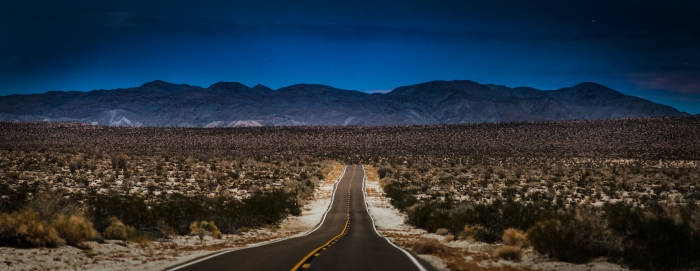
Moonlit night in the Anza Borrego Desert flats.
The road here stretches onward for miles and miles, dipping and rising through occasional slopes in the terrain but otherwise unbending. Stopping on the side of the road, the silence is almost overpowering, with not even the sound of a breeze coming through. Everything is absolutely still.
Looking North in the Anza Borrego Desert.
Following 78, You can either choose to take the road left into Borrego Springs and from there take the Borrego-Salton Seaway which leads directly to Salton City.
Otherwise, continue on the long stretch of desert. 78 will eventually terminate at the crossroads of highway 86 where you will take a left, turning north toward Salton City. After a stretch you’ll see the signs for it on your right.
TheSalton Sea.
Crystal Avenue. Salton City. Imperial County, CA
Located 100 miles East of San Diego in the Colorado desert, The Salton Sea was created in 1905 from a period of heavy rainfall that overwhelmed irrigation canals stemming from the Colorado river, carving two new rivers from the Colorado itself. This water continued to flow into the Salton sink for nearly two years before engineers could stop the flow, and due to there being nowhere for the water to drain (the Salton Sink itself is only a few feet higher in elevation than Death Valley) the waters created the largest lake in California. In the 1950’s real estate developers worked hard to make the Salton Sea a resort destination as popular as Lake Tahoe, laying streets lined with palm trees, stocking the sea with millions of game fish and dredging marinas complete with hotels and restaurants to accommodate vacationers. However, little attention was paid to the health of the Sea itself.
Looking back on Crystal Avenue.
Over time, chemical laden runoff from the surrounding agriculture of the Valley paired with rising salinity from evaporation polluted the Salton Sea. By the 1990’s fish and birds washed ashore in die offs numbering in the millions, creating a permanently foul stench in the air. Salton City and many of the Sea’s surrounding communities were largely abandoned to the elements. Much of the layout of the planned city and other communities that never came to be still remain, with unfinished houses lining streets leading nowhere and salt encrusted marina docks over dry land. Despite its current condition, or perhaps because of it, the Salton Sea is to me one of the most hauntingly beautiful places there is in California.
The shores of the Salton Sea. Colorado Desert. Imperial County, CA.
Alternative Route: The Great Southern Overland Stage Route.
An open stretch along the Great Southern Overland Stage Route.
I was on my way to the Salton Sea when I took a wrong turn off of 78 onto this road, and it having been awhile since I drove there I decided to keep going. It Didn’t end up taking me to the Sea, going almost directly South as it does, but i was glad i took the turn afterwards.
Early morning hours in the Desert. Imperial County, CA.
According to the Federal Highway Administration, The Great Southern Overland Stage Route (also just called the S2) was once a dusty trail used by the Spaniards when they still had control of this land in the late 18th century, and was used by Mexicans as a mailing route shortly after their war of independence from Spain. Mexican American War General Stephen Kearney used this trail to lead the Army of the West into Mexico, and miners used it throughout the gold rush period. Hell, even Mark Twain travelled on it in a mail wagon and wrote about it in his 1872 book Roughing It.
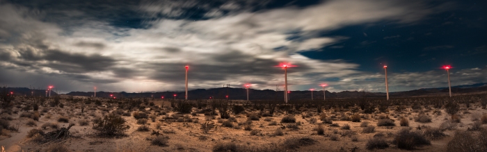
Windmills dot the landscape in the southern portion of the Anza-Borrego desert near Ocotillo, CA.
After driving for almost an hour I came over a rising and saw in front of me dozens of blinking red lights in the almost total darkness. I realized I had definitely taken a wrong turn and half expected border patrol to show up at any moment to ask why I was driving on a back-country road in what looked like a stolen car near the border at three a.m. That didn’t happen, but I did find out that the blinking lights were windmills turning silently in the early morning. It was quite a sight to see.
The city lights of Mexicali illuminate a distant storm. As seen from the windmills on the Great Southern Overland Stage Route leading into Ocotillo. Imperial County, CA
Special Mention-Slab City.
Home to Salvation Mountain, Slab City is..well, unfortunately I’ve never been there myself and don’t want to write about what I don’t know. Just read the wiki page on it, or watch this video vice made. I wager you’ll want to check it out yourself.